Ridge Kungoy Ala-Too
Our tours passing through Ridge Kungoy Ala-Too
Baibol services


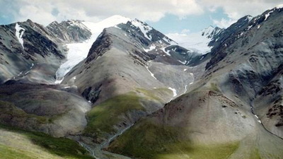
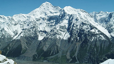
The Kungoy Ala-Too ridge is an arch facing the relief to the north and stretching east from the Boom gorge to the Santas Pass. The length of the ridge is about 280 km.; Its western extension is the Kyrgyz Ala-Too Range, and the Ketmen Ridge to the east. The average height of Kungoy Ala-Too is 3662 meters, the highest point is Chok-Tal (4771 m.), Located in the western part of the ridge in the sources of the river of the same name.
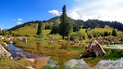
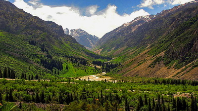
The ridge has a smooth crest; its southern slopes are quite steep and rise above the Issyk-Kul basin a short distance from the lake. Many rivers flowing from the mountains to the lake divide the ridge into wide and deeply embedded rocky gorges, some of which look like canyons (Cholpon-Ata, Chon-Aksuu, etc.), in the eastern part, they are covered with spruce forests.
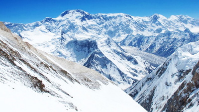
In comparison with Teskey Ala-Too, the Küngöy Ala-Too range has a small glacial area (237 km2), which occupies mainly its northern slope. The degree of glaciation of the slopes of both ranges facing the Issyk-Kul lake is very different: the glaciation area of the southern slope of Kungoy Ala-Too is 8 times smaller than the area of glaciation of the northern slope of Teskey Ala-Too, and is equal to 62 square kilometers.
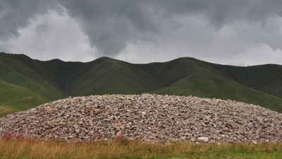
Kungoy Ala-Too is well preserved traces of ancient spurs and moraines. Here there are lakes that have morainic (arose at the bottom of mountain valleys, blocked by moraines) and a dam lake (originated as a result of the dam of the valley by mountain landslides) of origin. The most beautiful are the lakes Jashyl-Köl, Chon-Költor, Taldy, Kölsai.
About a hundred rivers take their origin in the mountains of Kungoy Alo-Too. Often, the names of the rivers flowing from the southern and northern slopes of the ridge coincide: Dore, Kabyrga, Cholpon-Ata, Ak-Suu, Chon-Aksuu, etc. Many valleys lead through the range to the valleys of Chon-Kemin and Chilik: Kalmak-Ashuu, Culthor, Ak-Suu, Syutbulak, Dore, Jetter, Jelkargai, Sarybulak, Shaty, and others.
Unlike Teskey, on the southern slopes of Kungoy Ala-Too, steppes predominate in the case of forest-meadow vegetation. The dry steppes on the plains are replaced with mountainous grassy steppes covered with feather grass, feather grass, fescue, geranium, and spruce as they rise upward. However, on the northern slopes facing the Chon-Kemin and Chilik valleys, the steppes give way to spruce forests and picturesque subalpine and alpine meadows.
On the northern slopes, as well as in the valleys of the eastern Kungoy Ala-Too, the most favorable climatic conditions for Tien-Shan firs have formed, which at an altitude of 2500-2600 meters completely cover the bottom and the lower part of the slopes.
The ridges of Teskey Ala-Too and Kyungyo Ala-Too are unique mountain systems of the Tien Shan, capable to impress the imagination of the most sophisticated travelers with a variety of landscapes, richness and beauty of wild nature.